
Construction Project for the Redevelopment of the Seafront Promenade of the Port of Palma | Port Authority of Balearic Islands | World Design Awards 2025
Port Authority of Balearic Islands: Winner of World Design Awards 2025. INTRODUCTION-Palma is a Mediterranean city with a privileged location within its bay and a maritime façade characterized by one of the most significant historic centers in the Mediterranean. This condition highlights the importance for the public administrations of ensuring an optimal relationship between the city and the sea.

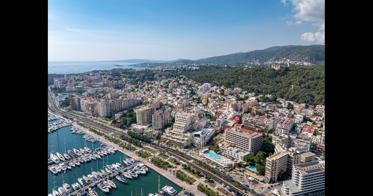
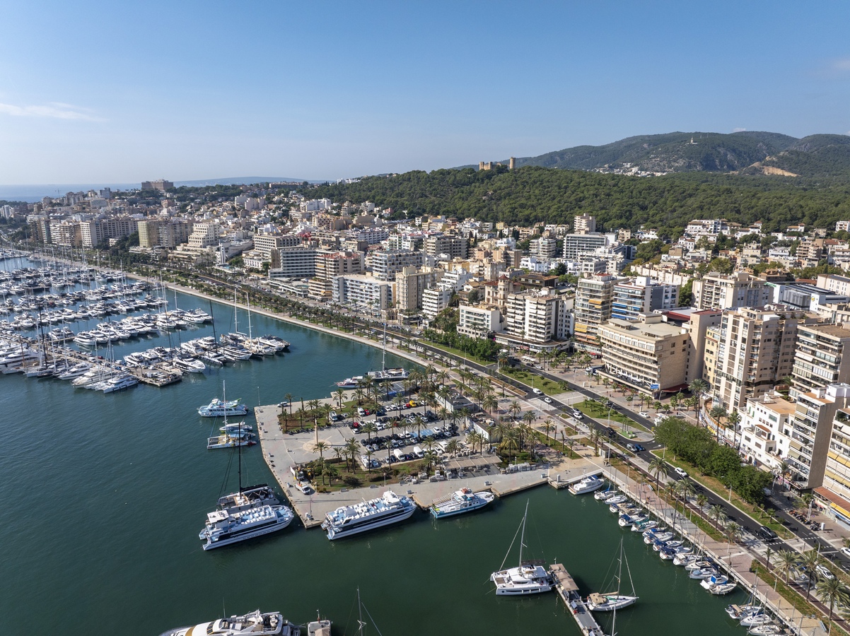
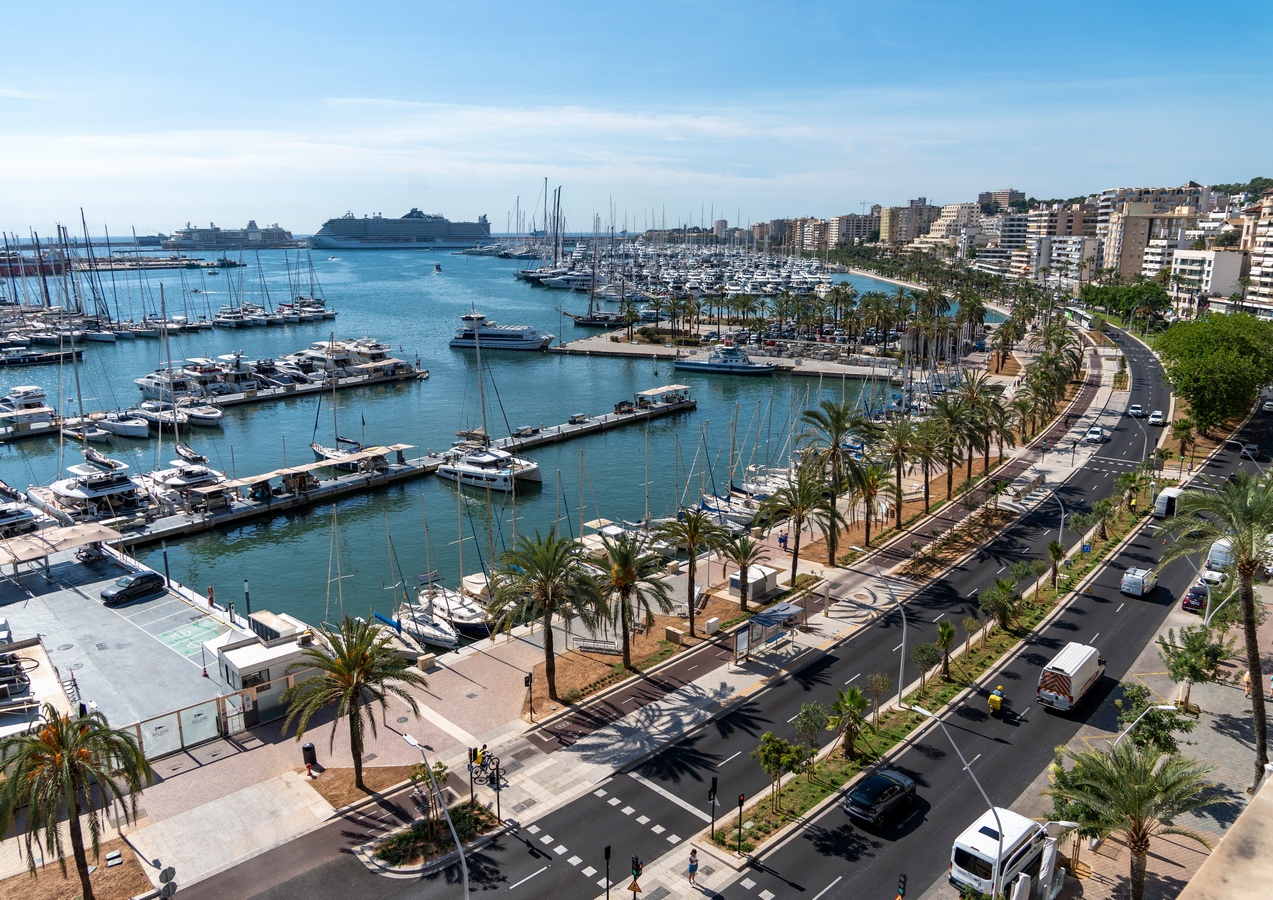
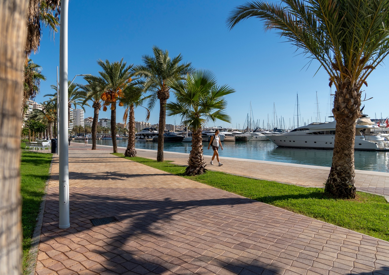
The Port of Palma, in the area of the Waterfront Promenade (“Paseo Marítimo”), is distinguished by having the largest number of recreational vessels in the Mediterranean, with more than 5,000 moorings. It is a key space for the city. However, it presents a series of deficiencies that reduce its usability and limit its potential as a structuring axis between the city and the port.
The project extends from the Porto Pi roundabout to the intersection with Avenida Argentina, covering 3.5 km of promenade and 190,000 m² of redevelopment.
The intervention stems from the decision of the Port Authority of the Balearic Islands (APB) to renovate the public space in order to enhance its heritage value (which will, in turn, benefit users and businesses operating in the port area), as well as from the willingness to shift the port-city model, mainly by changing the priority between cars and pedestrians/cyclists, and by increasing green areas.
Accordingly, a new mobility layout for the promenade is proposed, redistributing surfaces and uses. Currently, 50% of the area is dedicated to road traffic (carriageways), while the remaining 50% is allocated to pedestrian and cycling areas. These proportions are modified to achieve a 70% allocation for pedestrians, cyclists, and green spaces, and 30% for vehicular traffic.
This is achieved by reducing the number of lanes — from the current 3 or 4 per direction to 2 lanes per direction along the entire length of the promenade, except at intersections, where the median is widened to accommodate an additional turning lane. Lane width is reduced from 3.5 m to 3.25 m, and the number of on-street parking spaces is decreased.
The proposal is completed with a landscape design that preserves as many existing specimens as possible (301 trees and 516 palm trees). It includes the transplantation of 108 specimens and the planting of 1,820 new trees of 21 different species and 512 new palm trees, as well as the incorporation of shrub species, lawns, and ground covers in garden beds.
- History
The construction of the Waterfront Promenade on reclaimed land, designed to connect the historic city center with the new Paraires Port, completely transformed the western coastline of Palma. On the reclaimed land, a series of large buildings were erected, forming the new western maritime façade of the city. This intervention altered the original use of the area, fostering its transformation towards tourism and service-oriented activities.
It can be viewed in detail in the presentation attached to this document.
- LOCATION AND CURRENT STATE
- TOPOGRAPHY
The project area has a very gentle slope, except in the widened sections on the city side (such as Es Jonquet, Carrer de Ses Rafaletes, etc.), due to its condition as land reclaimed from the sea. However, the buildings located along the seafront are attached to the cliff, having access from two very different elevation levels.
The elevation of the promenade varies between +0.70 m and +2.60 m, while the elevation of the areas located on top of the cliffs —Es Jonquet, El Terreno, and Carrer Joan Miró— ranges between +13 m and +22.5 m, resulting in height differences of up to 20 m relative to the promenade, with virtually no horizontal development, making it difficult to overcome the slope.
Since the waterfront promenade is a platform reclaimed from the sea adjacent to the cliffs, the connections to the upper level are located where the former streams (torrents) used to flow.
- TOURISM
Tourist activity in Palma —and particularly along the Waterfront Promenade— is neither homogeneous over time nor uniform in visitor profile or intensity.
During the first decades of mass tourism, a large number of tourist accommodations were developed along the promenade, but their number declined significantly following the economic crisis of the 1970s. Currently, the accommodation capacity in Palma remains at around 48,000 beds.
On the other hand, there is a clear upward trend in cruise ship arrivals. In 2018 and 2019, approximately 600 cruise calls per year were recorded. Despite the halt in operations during the 2020 pandemic, forecasts indicated a return to similar levels. All cruise passengers represent potential users of the Waterfront Promenade, as it serves as their main gateway to the city.
In any case, the current figures reflect the shift that began in 2015, with a commitment to sustainable and responsible tourism, focused on quality, aiming to generate less impact on the territory, consume fewer resources, and at the same time include mechanisms to compensate for its footprint and redistribute the wealth it generates.
One of the main objectives of the Waterfront Promenade Redevelopment Project is to improve environmental sustainability, quality, and the aesthetic appearance of the public space. The interventions carried out along the promenade are expected to contribute to attracting tourists with higher purchasing power, which in turn will enhance the economic performance of the businesses operating in the area.
- NIGHTLIFE
Night-time recreational activity on the island of Mallorca has been, for over half a century, one of its main attractions. The island was a pioneer in nightlife entertainment, associated with glamorous venues where an elite of artists and bourgeois society created fantasy environments in which music and dance played a central role.
Palma’s nightlife takes place in various areas, notably the Waterfront Promenade (Paseo Marítimo), Gomila, Can Pastilla, and s’Arenal.
The Waterfront Promenade is the most visited, most exclusive, and most glamorous nightlife area in Palma. Its wide range of bars and clubs attracts large crowds from all over the city, creating a vibrant night scene. Located at the center of the bay’s coastline and stretching over two and a half kilometers, it hosts the best-known nightclubs and pubs in Mallorca’s nightlife.
During winter, it is frequented mainly by local residents from Palma and the rest of the island, while in summer, tourists join in, ensuring activity throughout the year —although winter activity is mostly limited to weekends.
The area is considered the most prestigious and strategically located nightlife district due to its proximity to the city center and its nautical and maritime surroundings.
- PURPOSE OF THE PROJECt
The purpose of the proposal is to enhance the port–city interface along the Waterfront Promenade of the Port of Palma, ensuring continuity of Palma’s maritime frontage, where vegetation and landscaped leisure areas become the main features. The diversity of building heights, forms, and alignments makes it difficult to achieve a unified character in this continuous urban space of the modern city.
The project aims to highlight the promenade adjacent to the water, concentrating vehicular traffic alongside the wide sidewalks that border the sequence of buildings, while creating large green areas facing the sea along the promenade and promoting the use of sustainable means of transport throughout the area.
In parallel, the Port Authority of the Balearic Islands (APB) has proposed the renewal of the public space in order to enhance the heritage value of the waterfront, which will ultimately result in improved conditions for users and businesses operating in the port area.
- MAIN LINEA OF ACTION. OBJECTIVES
1. Improve the transversal permeability between the Port and the City
The road section is optimized (two lanes per direction: 6.5 m + 6.5 m), minimizing the occupation of public space by vehicular traffic, thus ensuring and facilitating transversal permeability along the promenade. In accordance with the guidelines established in the AAP, pedestrian crossings are located every 100 meters (except in specific cases), coinciding with all potential future accessible connections to the El Terreno neighborhood mentioned above. In this way, unlike the current situation, the promenade becomes a structuring axis at both local and citywide scales.
2. Reduction of traffic and improvement of longitudinal continuity for cyclists and pedestrians
To improve the continuity of the promenade, intersections and access points are redesigned to reduce vehicle speed and minimize pedestrian crossing distances. Crossings and pedestrian paths will be controlled by traffic lights to increase safety and prevent excessive vehicle speeds.
By locating the traffic lanes adjacent to the buildings, the “Waterfront Promenade” area gains width, providing a continuous and uninterrupted route for pedestrians and cyclists with minimal interference.
3. Unification of residual spaces to create new public areas linked to the promenade
Following the AAP proposal to reduce the roadway from six to four lanes, the new layout defines a consistent section: (linear planter 1.5–5 m + cycle lane 2.8 m + linear planter 2.8 m + two lanes 6.5 m + median 3 m + two lanes 6.5 m + parking 2.2 m), aligned parallel to the existing building line. This configuration leaves sidewalks between 7 and 10 m wide, allowing the coexistence of terraces and generous pedestrian space, as well as the preservation of existing palm trees.
The dimensioning of sidewalks also accommodates widened zones on the seafront, with variable widths between 14 and 40 m. Existing surface parking areas and large vegetated islands without public use between roadways are eliminated and consolidated into larger pedestrian areas facing the sea. Further characteristics of these areas are described in later sections.
4. High-capacity public transport line along the promenade
The project seeks to promote high-capacity public transport and to locate bus stops near the new accessible connections to the El Terreno neighborhood, thus improving overall mobility.
5. Renaturalization of the promenade
A radical transformation of the promenade’s image and limited vegetation is proposed through the planting of 1,678 new trees, the creation of 37,351.72 m² of landscaped areas with salt-tolerant shrub species, and the installation of permeable pavements in parking zones. The drainage system of the promenade will be integrated into the planters to improve tree irrigation.
6. Regulation of public space occupation
Sidewalks are dimensioned to allow the coexistence of pedestrian flow and outdoor terraces. Nevertheless, it is considered essential to reorganize public space occupation through the standardization and modular arrangement of terrace concessions, always ensuring pedestrian priority.
- PROJECT DESCRIPTION
- THE WATERFRONT PROMENADE AND THE CITY
In accordance with the project objectives, the urban development design has been defined to address all the requirements specified by the Department of Urban Planning (Gerència d’Urbanisme), the Department of Mobility, the Department of Infrastructure, and the Parks and Gardens Service (Servei de Parcs i Jardins) of the Ajuntament de Palma, as well as by the Port Authority of the Balearic Islands (APB), EMAYA, and other stakeholders involved in the area. In this way, the project establishes a consensus-based solution that integrates the participation and agreement of all these entities.
- URBAN DEVELOPMENT PROPOSAL
The proposal is based on a simple, yet comprehensive approach aimed at addressing all the specific conditions present along the promenade through the installation of new sidewalk pavements accompanied by abundant landscaped planters, providing the promenade with a unified visual identity.
While maintaining the essence of the current cross section, the entire promenade is designed with a slight slope (less than 2%) towards the sea, enhancing the visual connection across its full width.
The following sections describe the main components that make up the proposal, followed by a detailed explanation of the distinctive features of each segment of the promenade.
- MOBILITY FEATURES
Reduction of traffic lanes: The existing 3–4 lanes per direction are reduced to 2 lanes per direction.
- Additional turning lanes.
The median strip between both traffic directions is widened or reshaped at intersections to accommodate an additional turning lane, preventing turning movements from interfering with longitudinal traffic flow. The median is maintained to minimize the visual width of the asphalt surface and to facilitate pedestrian crossings. This configuration is implemented at five locations along the promenade.
- Parking.
On-street parking is provided only on the building side, with capacity for approximately 300 vehicles. On the seaside, areas are designated for loading/unloading and coach parking where necessary—such as near the entrances to the marinas and the Restaurante Dársena. This minimizes the visual impact of parked vehicles on the promenade area and ensures unobstructed sea views.
The mobility service of the Palma council will determine the proportion of parking spaces for cars, motorcycles, and loading/unloading areas according to current mobility needs.
Both surface parking (cars and motorcycles) and new and existing underground car parks complement the parking offer, as described in Section 5.3.5 of this report.
- Bus stops.
Bus stops are 18 meters long and located 12 meters from pedestrian crossings to ensure adequate service for pedestrians. This layout allows buses to operate even when vehicles are stopped at traffic lights, minimizing their impact on traffic flow.
On the city side, bus stops occupy space originally designated for parking, thereby freeing sidewalks from obstacles. On the seaside, they are placed within the median strip (2.80 m wide) between the roadway and the cycle lane, with access from both sides, one of which connects directly to the pedestrian crossing.
- Bicycle parking.
Along the cycle lane, five bicycle parking areas are provided, each accommodating 12 bicycles, equipped with stainless steel inverted U-shaped racks anchored to the pavement.
- PAVING AND URBAN ELEMENTS
Roadway areas.
The traffic lanes will be paved with asphalt concrete. A 30 x 30 cm gutter will be installed on both sides, matching the width of the required drain inlets, ensuring their integration within the same alignment.
The bicycle lane will be paved with colored asphalt, with the pigment mixed into the mass —in a reddish-maroon tone (RAL to be defined during construction based on samples)— and will include 20 x 20 cm gutters on both sides (with drain inlets of the same width).
The parking areas will be paved with 20 x 20 x 10 cm granite pavers, with open joints laid on compacted soil, thus creating permeable paving surfaces to improve subsoil irrigation and stormwater infiltration.
Pedestrian areas.
The paving of sidewalks and the promenade is resolved using four different types of surfaces:
- Colored concrete pavers: The main paving for sidewalks and the promenade has been specifically designed for this project. It will consist of colored concrete pavers (six different tones, in equal proportion, to be placed as directed by the Construction Management):
Ocher-white (sand), ocher-gray (autumn), ocher-reddish, ocher-purple, ocher-brown, and ocher-black. The pavers will be trapezoidal in shape, of the XARXA type by Escofet or equivalent, with regular cuts and approximate dimensions of 15 × 15 × 10 cm. They will be laid on a 3–5 cm sand bed, all in a single direction parallel to S’Aigo Dolça Street, to avoid having to rotate the pieces along the curved layout of the promenade. The edge pavers and those adjoining tree pits, planters, and other urban elements will be set on a mortar bed to provide greater adhesion for the cut pieces.
- Vehicular crossings over sidewalks will be identified differently depending on their characteristics:
- Streets: finished with the same concrete paving but in black color, without bollards.
- Accesses to car parks (not perpendicular to the street or longer than 10 m): marked with stainless steel markers, 10 cm in diameter, embedded and flush with the paving surface.
- Tactile paving. The striped tactile paving will be made of colored concrete pavers, measuring 20 × 20 (30) × 10 cm, in an ochre-white (sand) tone.
- Granite elements. On both sides of the promenade, a variable-width strip will be paved with granite slabs measuring 40 × 80 × 10 cm. This strip accommodates parking spaces, utility networks, electrical cabinets, traffic signal controllers, manholes, bus shelters, underground waste containers, and other elements, with the aim of organizing and rationalizing urban components.
- Curbs, tree pits, ramps, planter edges, and lighting pole bases within the planters will all be made of granite.
- The curbs will have a trapezoidal cross section (20 × 24 cm) and a maximum visible height of 14 cm.
- For tight curves, special curved exterior / straight interior pieces will be manufactured to ensure proper connection with the planter edging.
- In front of bus stops, the curb edge will be chamfered to prevent tire damage.
- At drain inlets, “mailbox-type” curbs will be used.
- Tree pits. These will be heptagonal, with an inner width of 143 cm (1.47 m²), exceeding the minimum 1.05 m² required by the Parks and Gardens Service of the Ajuntament de Palma.
- In specific cases with limited space, the width will be 90 cm.
- For large existing trees such as Ficus and Pine trees, the pits will be 180 cm wide.
- If any existing tree requires a larger pit, its size will be adjusted accordingly.
- Each tree pit will be finished with a flat granite frame with a rectangular cross section of 10 × 24 cm.
- The pits will be aligned so that one of their sides runs parallel to the roadway.
- Planters. They will be delimited by 10 cm-wide granite edging, with the top surface slightly sloped toward the planting area, and flush with the surrounding pavement or curb on the outer side.The same granite piece will be used in medians to increase the separation between shrub planting and the roadway.
- Lighting pole and mast bases. A special octagonal granite base is proposed to provide support and protection against moisture and soil contact for lighting poles and masts located in the central median.In cases where both a lighting pole and Wi-Fi column (or two poles) coincide, a larger special base will be used.For traffic lights placed within planters, a truncated octagonal base is also proposed.
- Pedestrian crossings. Standard pedestrian crossings will have a clear width of 4.80 m, except in special cases where space constraints limit them to 4.00 m, or in notable areas such as the connection between the Auditorium and the Muelle Golondrinas esplanade, where a 12 m-wide crossing is proposed, anticipating the future multifunctional use of that open space.
- Ramps will have a depth of 1.40 m to ensure a maximum slope of 10%, made with two granite slabs of 40 × 80 cm and 40 × 60 cm – the latter with tactile button surface, shaped by milling. All finishing pieces will be chamfered to eliminate sharp edges and facilitate pedestrian mobility, minimizing topographical obstacles.
Vehicular ramps.
Vehicular ramps will have a depth of 140 cm, made as a single-piece element, and will be set forward into the parking strip, creating a buffer space with the sidewalk to facilitate turning movements, minimize traffic interference, and ensure pedestrian safety.
Corner pieces will be curved, allowing a smooth transition between the curb plane and the inclined surface of the ramp slabs, thereby improving driving comfort and enhancing pedestrian protection.
- Binissalem limestone. On the city side, interventions related to terrain level differences (stairs, ramps, etc.) will be executed using Binissalem limestone paving, the same material currently used in the retaining wall finishes, maintaining consistency with the existing character. Special finishing elements, drainage channels, and gargoyles have been designed to provide a high-quality appearance and ensure greater durability.
A special edging piece, measuring 30 × 60 × 20 cm (in granite or Binissalem limestone, depending on the adjacent pavement), is defined for edges and level transitions. These pieces are often machined to serve as supports for the anchoring of the proposed hot-dip galvanized steel railing.
- Sand-gravel mix surface. The esplanade in front of Santo Domingo de la Calzada will be paved with sauló (a natural compacted sand-gravel mix), and will be linked to the children’s play area.
- Rubber surfacing. The children’s play area itself will be paved with rubber flooring in sauló color to maintain visual coherence while ensuring safety and comfort.
The existing quay edge (cantil) will be preserved, being made of stone in some areas and concrete in most sections.
- SPECIALITY FEATURES BY SECTIONS
The project is described with its specific features divided into sections, according to the distinct characteristics identified along the promenade.
SECTION 1. FROM THE PORTO PI ROUNDABOUT TO THE PARAIRES TOWER
The absence of vegetation and the topography of the areas opposite the sea —featuring a 4-meter elevation difference between the building entrances and the promenade— together with the military enclosure fence and the crash-barrier fencing, hinder the urban character of this section and give it an inhospitable appearance.
The presence of the shopping center at the end of the promenade currently contributes to this disconnection, as the building is opaque and disengaged from the public realm, with its access primarily designed for vehicles. The building is now undergoing redevelopment, with the Executive Project under preparation, in order to improve its relationship with the city.
The project also includes the redevelopment of the public space in front of the shopping center, including the square adjacent to the Porto Pi roundabout. It is considered that the shopping center could become an important focal point of attraction.
The public space between the promenade and the shopping center will be redeveloped by the shopping center’s management, and the works of both projects have been coordinated to ensure full compatibility and continuity.
- A continuation of the standard cross section of the promenade is proposed, adding —in the direction of Calvià— a third right-turn lane before reaching the roundabout, in order to prevent traffic congestion in this area. However, the limited available width does not allow the central medians to be maintained at the same dimensions as in the rest of the promenade. Consequently, the central median is reduced to 2 m in width (the minimum required for tree planting, according to the guidelines of the Parks and Gardens Service of the Ajuntament de Palma), while the median between the traffic lane and the cycle lane is reduced to 1 m, the minimum necessary to provide adequate protection for cyclists.
- The available cross section is insufficient to accommodate the required width ensuring a 5 m sidewalk on the mountain side, continuity of the cycle lane, and the planting of three rows of trees to provide ample shade. Therefore, it is necessary to gain additional space by constructing a new retaining wall in front of the residential buildings between Porto Pi and Paraires. This allows for an obstacle-free sidewalk of 3.5 m on the city side and 2.8 m on the seaside.
- The road grade is adjusted at the intersection with the exit ramp of the shopping center car park to ensure adequate width and a seamless connection with the existing ramp.
- A new staircase is proposed to connect the upper level of the retaining wall with Carrer de Ses Rafaletes.
- The intersection of the promenade with Carrer de Ses Rafaletes is redesigned, giving priority to pedestrians, and resolved with a ramped crossing. A new pedestrian path is proposed on the vegetated slope between Carrer de Ses Rafaletes and Carrer de Torre Paraires to improve pedestrian connectivity. It is suggested to modify the existing monumental staircase, reducing its width to gain additional green space.
- The access to the 12-storey residential building facing the tower is also reconfigured, providing a turning area with a single shared access and exit point.
- Benches are placed at the central point, in front of a widened sidewalk area, facing the sea and backed by the cycle lane, encouraging walking and offering rest areas for pedestrians.
SECTION 2. FROM THE PARAIRES TOWER TO THE CLUB DE MAR
This section is characterized as the only part of the promenade without a direct visual connection to the sea, as it is separated from it by the Poniente docks. It is an area with heavy traffic of large vehicles. The Port Authority of the Balearic Islands (APB) is currently reorganizing the access area to the Poniente Docks to improve and optimize port operations and internal traffic, ensuring that heavy vehicles enter and exit exclusively through Porto Pi, thereby preventing their circulation through the city.
This mobility solution also makes it possible to consider the demolition of the bridge connecting to Avenida Joan Miró, which would significantly enhance the quality of the promenade.
On the city side, the sidewalk is widened under the building arcades, which are spaces ceded for public use.
The Club de Mar, currently with its Execution Project under review, will undergo a major transformation to improve its relationship with the city, incorporating a public pedestrian passage through its premises.
- The Paraires Tower, a heritage-protected structure (Level A1) recently restored, will be preserved and integrated within the sidewalk area. A new surrounding planter is proposed to protect it from vandalism. Due to the limited cross-section width, the sidewalk will run behind the tower, ensuring its protection and stability during construction.
- In front of the tower, the lighting poles will be relocated to the central median, preventing visual interference with the monument while providing adequate illumination.
- It is suggested that the paving of the private arcades of adjacent buildings be matched with the promenade paving, creating a uniform visual identity across the full sidewalk width.
- A new staircase is proposed to overcome the elevation difference between Avenida Joan Miró and the promenade, replacing the existing one.
- With the demolition of the bridge, a new retaining wall will be built, allowing the widening of the sidewalk, the creation of new green areas, and the removal of the current bridge support columns that obstruct the seaward sidewalk.
SECTION 3. CLUB DE MAR AND CAN BARBARÁ AREA
A section located between two waterfronts —the Club de Mar on one side and the Can Barbará marina on the other.
- According to the Execution Project of the Club de Mar, agreed upon with the Port Authority of the Balearic Islands (APB), the Ajuntament de Palma, and the design team of this project, the existing perimeter fence will be replaced by a 1-meter-high vegetated fence, measured from the promenade level.
- The intersection leading to Avenida Joan Miró will be redesigned to reduce vehicle speed and facilitate the longitudinal continuity of the pedestrian route.
- The fence of the Can Barbará marina will also be replaced with the same stainless steel flat-bar fence (AISI 316) used throughout the rest of the promenade, ensuring visual and material uniformity.
- The lighting system and security cameras of the Can Barbará marina will be relocated and integrated into the new promenade layout.
- A new left-turn lane is added for vehicles heading toward the historic center, providing access to Carrer de la Pedrera. This intersection will also function as a turnaround point.
- The service lane between the former Pachá nightclub and Carrer de la Pedrera will be maintained, with access through curb ramps, giving priority to pedestrians.
- Existing parking spaces in this area will be preserved.
SECTION 4. FORMER HOTEL MEDITERRÁNEO SWIMMING POOL AREA
The swimming pool of the former Hotel Mediterráneo, located at street level, together with the adjacent music club, currently represents a major obstacle to the redevelopment of the promenade. The expiration of their administrative concession provides a significant opportunity to relocate the four traffic lanes closer to the building façade, thereby expanding the pedestrian promenade along the seafront to a width of up to 40 meters.
This newly gained space allows for the creation of landscaped planters with gentle topography and shrub vegetation, serving as a visual and physical buffer from the roadway, while generating pleasant green pockets along the promenade. The inclusion of naturalized grass areas within the planters will create spaces where visitors can lie down and relax by the sea, shaded by abundant tree cover.
The planters divide the promenade into two distinct zones:
- One directly facing the sea, offering open views and a more dynamic circulation; and another more sheltered pathway, set among vegetation and shaded areas, providing a quieter and more intimate atmosphere.
Within the planters, recessed seating areas are designed to accommodate groups of benches, sheltered from the main pedestrian flow, ensuring comfort and unobstructed movement for promenade users.
- In front of the Palma Real residential complex, the proposal includes preserving the existing planters while replacing the current paved areas with the same pavement used throughout the rest of the promenade, thereby achieving greater visual and material unity.
- In the corner opposite the “Jardins de Sa Quarentena”, the introduction of a new planted area (parterre) is proposed to eliminate the existing urban void and enhance the landscape continuity.
- Vehicular access to the piers will be maintained, but at sidewalk level, giving priority to pedestrians and cyclists. Loading and unloading areas will be provided in front of the piers, within the width of the continuous planter that accompanies the promenade, ensuring the operational functionality of these facilities.
- Provision is made for a curb ramp (vado) for a potential future access to the public car park planned next to the former Hotel Mediterráneo.
- Similarly, access is provided to the future car park of the Hotel Victoria by Meliá, located in front of Tito’s square.
- At the intersection with Carrer S’Aigo Dolça, a third turning lane in both directions is designed, enabling U-turns and direct access to S’Aigo Dolça Street.
- An additional uphill lane is proposed along S’Aigo Dolça to access the future underground car park beneath the new swimming pool (currently under detailed design), thus expanding the underground parking capacity along the promenade. The access ramp to the street is set back, allowing for the conversion of the city-side parking strip into a merging lane towards S’Aigo Dolça if needed.
- The sculpture affected by the new alignment of Carrer S’Aigo Dolça will be relocated within the same square.
- It is also suggested to pave all recesses, arcades, and cul-de-sacs along the promenade—particularly concentrated in this section—to create a more unified sidewalk appearance and reduce the sense of fragmented urban spaces currently present.
- Among the promenade’s planters, the installation of a 20-meter-high sculptural element, titled “Grumet Meteora”, is planned. This artwork will also serve as a meteorological station, providing real-time information such as time, orientation, wind speed and direction, precipitation, solar radiation, location, and air pollution index.
- Additionally, a children’s play area is proposed within a sheltered planter, surrounded by vegetation, offering abundant shade and direct views of the sea, creating a safe and enjoyable space integrated into the natural setting of the promenade.
SECTION 5. AUDITORIUM
In front of the Auditorium, several existing elements determine the resulting cross section:
- Palm trees in the median, of high heritage value.
- Large Ficus trees in the median, providing abundant shade.
- The need to accommodate a turnaround roundabout with turning radii suitable for coaches.
- The objective of creating a wide sidewalk in front of the Auditorium.
- The intention to emphasize the building’s axial relationship with the sea.
Accordingly, the typical cross section varies under the following conditions:
A wider sidewalk is proposed by removing the parking spaces located in front of the façade (a total width of 18 m), creating a plaza-like entrance area that extends up to the palm trees currently located in the median.
A pedestrian crossing is designed axially aligned with the Auditorium, and will be twice as wide as the standard crossings along the promenade, highlighting the architectural prominence of the building and responding to its future function as a multipurpose space and large plaza for events associated with the Golondrinas platform.
The two squares located on either side of the Auditorium will be paved at sidewalk level, maintaining the Marc Ferragut monument, the service area for trailers, and the existing car park accesses. In these areas, a reinforced concrete slab will be installed to support the expected additional loads.
The median will be widened to 15 meters, ensuring sufficient space for coach U-turns while preserving the existing Ficus trees.
On the seaside, the cycle lane will be slightly realigned, and the planter between the roadway and the cycle lane widened to accommodate coach parking bays.
These will be laid out parallel to the curb (cordon type) on both sides of the Golondrinas platform, providing 3–4 spaces per side (for a total capacity of 9–12 coaches).
This configuration will free the Auditorium from the current visual and physical obstruction caused by coach parking. Stopping will be limited to loading and unloading only, requiring coaches to park elsewhere during waiting periods, thus improving traffic flow and reducing the occupation of public space.
Planters will also be introduced following the same design criteria as in the former Hotel Mediterráneo pool area, creating rest zones sheltered by vegetation from road traffic.
The existing sundial at the end of this section will be preserved and respected.
SECTION 6. TORRENT DE SON ARMADANS
Between Carrer Llinàs and Plaça Santo Domingo de la Calzada, several key constraints must be preserved, which determine the layout of this section:
- The available roadway width is significantly reduced.
- A left-turn lane is required to allow vehicles to turn towards Carrer Monsenyor Palmer.
- In the promenade area, there is a 90 cm elevation difference between the carriageway and the pedestrian level. This is resolved by the construction of a retaining wall, adjusted according to the available section.
- The bridge over the outfall of the Torrent will be widened, and a ramp system will be created to provide access to the existing restaurant.
- The Restaurante Dársena, located at promenade level, will be preserved.
- Vehicular access at promenade level will be maintained to allow connection to the pier opposite Torrent de Sant Magí.
- Several existing pine trees in the median will be retained.
These limitations and conditions necessitate more extensive construction works than in other sections:
- The construction of a new retaining wall, which reduces the width of the seafront promenade, in order to fit the standard cross-section within the available space.
- The enlargement of the Torrent de Son Armadans outlet.
- The construction of new ramps to overcome the elevation difference and connect both levels.
All walls and stairways will be clad in granite, following detailed design specifications. The retaining wall will be finished with a hot-dip galvanized steel railing, identical to that used throughout the promenade, replacing the existing concrete balustrade railing.
Additional considerations:
- During events at the Auditorium, part of the parking area may be temporarily used to access the Marquès de la Sènia car park, minimizing traffic disruption.
- The parking area of the Restaurante Dársena is proposed to be removed, converting it into a new public plaza facing the sea. Vehicular access will be maintained, with a loading and unloading bay provided on the seaside at promenade level.
- The recently constructed cycle lane on Monsenyor Palmer will be continued through the promenade, ensuring a connection between both cycling routes.
SECTION 7. ES JONQUET
At Santo Domingo de la Calzada, the proposal involves removing the existing service lane to create a large multifunctional plaza that incorporates new accessibility systems and enhances the connection between the Waterfront Promenade and the upper neighborhood, through the construction of a new pedestrian staircase and ramp.
The design takes into account the “Special Protection Plan for the Es Jonquet Neighborhood”, currently at the stage of initial approval and pending final approval, which sets out the intervention criteria and ensures the protection of the escarpment that supports the historic slope separating the Es Jonquet district from the sea, as well as the restoration of the Santo Domingo de la Calzada monument.
- To emphasize the unique character of the area, limestone paving and cladding will be used. All specific details are defined in the corresponding drawings.
- The new retaining walls will be faced with irregular stone, consistent with the adjacent retaining walls, providing visual and material unity to the ensemble. The existing concrete wall will be painted for protection and aesthetic improvement.
- A new ramp and staircase are proposed in front of the wall to improve accessibility to Es Jonquet, positioned symmetrically with respect to the monument. A large landing is created at the elevation of the current platform to ensure proper visibility and appreciation of the monument.
- The existing elevated platform, currently a marginal and poorly accessible space, separated from pedestrian flow, will be dismantled. The area around the Santo Domingo de la Calzada monument will be integrated into the promenade, with gentle slopes extending the walkway and plaza area.
- A sunken area within the vegetated slope will be created to host children’s play spaces, sheltered and shaded, and closely linked to the sauló esplanade.
- The esplanade will be paved with improved sauló, forming a multi-purpose public space that preserves the historical essence of this site. The existing central sundial will be maintained in its current position.
- Vehicular ramps (vados) will be provided on both sides of Santo Domingo de la Calzada, allowing service and delivery access to the nearby premises, replacing the former service lane.
- MOBILITY
- ROAD SYSTEM
Currently, along Avenida Gabriel Roca, between the Joan Miró roundabout and Avenida Argentina, there are a total of 12 intersections, of which 10 are located on the inland side, in addition to the Porto Pi overpass and two U-turn points situated between Carrer de la Pedrera and S’Aigo Dolça. Left turns are also permitted from Carrer de la Pedrera, Carrer Monsenyor Palmer, in front of the Auditorium, and at the Avenida Argentina intersection.
In addition to the aforementioned reduction from three to two lanes on Avenida Gabriel Roca, the promenade’s road configuration is also modified in other sections and aspects, introducing a new functional and morphological layout to improve overall traffic flow and pedestrian connectivity.
In addition to the previously mentioned reduction from three to two lanes along Avenida Gabriel Roca, the promenade redesign introduces several modifications to the roadway configuration in different areas:
- Porto Pi – Muelles de Poniente – Paraires connection. The existing overpass is eliminated, and all traffic movements will occur at grade level. A new left-turn lane will be incorporated at the access to the Maritime Station, opposite the Paraires Tower. Two new intersections will be created on the port side: one providing inbound access towards the city center, and another outbound towards the Ma-1 motorway. The Porto Pi Street intersection will also be reconfigured to include three lanes, one of which will serve as a left-turn lane towards the center of Palma.
- Carrer de la Pedrera. In addition to the existing left turn towards the city center, vehicles will also be allowed to turn left from the promenade into Carrer de la Pedrera. Furthermore, U-turns will be permitted via a dedicated lane from the central median, restricted to light vehicles only.
- Carrer S’Aigo Dolça. This street, which currently operates as a one-way entry from the promenade, will become a two-way street up to the planned car park. As with Carrer de la Pedrera, all left turns from the promenade will be allowed, as well as U-turns using a dedicated median lane for light vehicles.
- Auditorium area. In the vicinity of the Auditorium and Golondrinas pier, a U-turn facility will be implemented. Due to the wider median in this area, it will be suitable for bus maneuvers.
- Carrer Monsenyor Palmer. The current configuration will be maintained, preserving left turns both towards the promenade and from the promenade into the street, with a dedicated turning lane. The recently constructed cycle lane has been taken into account in the design.
- Plaça Santo Domingo de la Calzada. The existing circumferential roadway around the square will be removed. Access will be restricted to local service and deliveries, allowed from both ends via a shared-surface platform (single-level roadway and sidewalk).
- Avenida Argentina. The current configuration will be maintained, allowing left turns both towards the promenade and from the promenade into the avenue, with a dedicated turning lane.
- CYCLE LANE
Cycling must be regarded as a priority mode of transport along the Waterfront Promenade, not only due to its already consolidated high demand, but also as a viable and sustainable alternative to replace trips that are still made using motor vehicles.
Currently, the existing cycle lane functions as a two-way route over a limited section of the promenade. To encourage greater use, it is essential to ensure route continuity and safety for users.
Accordingly, the project includes the construction of a continuous cycle lane along the entire length of the promenade, maintaining a uniform width of 2.8 meters. The lane is located on the seaside, running between landscaped planters or between the separating planter and the sidewalk, thus ensuring safe segregation from vehicular traffic and comfortable integration within the public space.
- PEDESTRIAN MOBILITY
The mobility study indicated that the pedestrian infrastructure is insufficient for the volume of foot traffic recorded, particularly on the inland side, where sidewalk narrowings are common. Additionally, transversal permeability is limited due to the low number of pedestrian crossings and the long distances between them. Pedestrian mobility must ensure both universal accessibility and safety, which are the two key principles guiding the design of the intervention.
One of the main safety priorities is to improve transversal permeability in order to prevent unsafe crossings by pedestrians. In this regard, the proposal includes a significant increase in the number of pedestrian crossings, from 11 existing crossings to a total of 24. A particularly notable improvement is made in the Auditorium area, which previously lacked a direct connection to the Golondrinas pier, now achieved through the new configuration.
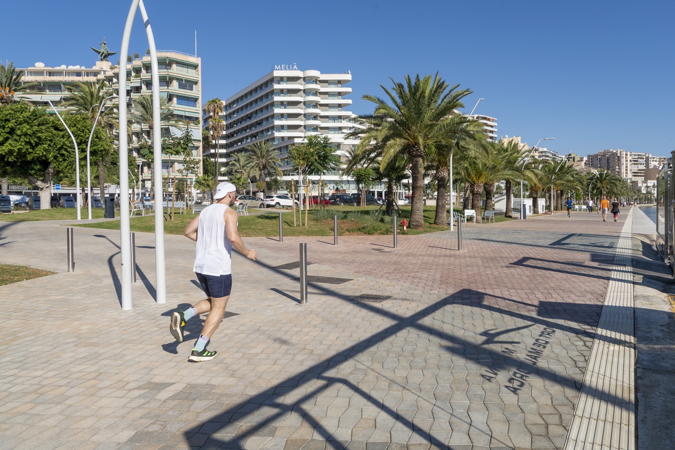
As for the existing narrow sections on the inland side of the promenade, the design generally widens the sidewalks throughout the entire stretch, providing widths between 7 and 10 meters, and maintaining a minimum width of 5 meters in the most constrained sections of the avenue.
Another previously problematic area —the port frontage near the Torrent de Sant Magí— has also been resolved: the sidewalk width has been increased from 2 to 5 meters, and the connection with the lower quay level has been significantly improved, enhancing both pedestrian comfort and accessibility.
- PUBLIC TRANSPORT
Currently, two urban bus lines operated by EMT Palma (lines 1 and 41) run daily along the promenade, with an additional line, 29, that coincides only along the stretch between Carrer Monsenyor Palmer and Avenida Argentina. There are five to six bus stops, depending on the direction of travel, some of which are shared between urban lines (EMT) and interurban lines operated by TIB.
As noted in the mobility study, this corridor is not considered a major public transport axis, as service frequency is relatively low, averaging 3 to 4 buses per hour. Due to the redevelopment of the promenade, the bus stops for the existing lines have been relocated based on indications provided by EMT. In some cases—such as for line 1—the removal of the Porto Pi–Paraires overpass will require a route modification in that area.
With regard to the future implementation of a high-capacity public transport system, such as a tramway or Bus Rapid Transit (BRT) system, although the current cross section limits the possibility of integrating a fully segregated platform, it is entirely feasible to implement either system on a shared platform. This configuration aligns with the current design philosophy of traffic-calmed avenues, similar to those successfully adopted in several European cities.
- PARKING
There is a wide range of parking options available around the Waterfront Promenade, including public car parks, regulated zones, and free parking areas. At present, there are 1,341 surface parking spaces between Carrer Monsenyor Palmer and the Porto Pi roundabout. Of these, approximately 314 spaces operate under a night-time schedule during winter weekends, serving residents and visitors to restaurants and nightlife venues, while the remaining 1,027 free spaces are used by visitors, local employees, and city residents.
Within the project area, five public car parks are located:
- Parc del Mar, with an approximate capacity of 850 spaces, which only reaches full occupancy during peak summer periods.
- Marquès de la Sènia, located about 200 meters from the Auditorium, with 529 spaces (263 short-stay and 266 for residents).
- Local Maritime Station, a small car park with approximately 70 short-stay spaces.
- Joan Miró Car Park, with 130 spaces.
- Porto Pi Shopping Center Car Park, a large-capacity facility with approximately 1,500 spaces.
Surface parking in the area is regulated between Avinguda Antoni Maura and Avinguda Argentina on the eastern side, and around the maritime terminal on the western side.
In addition, there are other nearby car parks serving the promenade area:
- S4 – Antoni Maura Car Park, with 836 spaces, of which 743 are short-stay.
- C8 – Passeig Mallorca Car Park, with 435 spaces.
Future projects include the creation of new parking facilities within the promenade area to compensate for the loss of surface spaces following the redevelopment works:
- D6 – Comedor de Ponent (park and ride facility): approximately 350 spaces.
- E3 – Plaça Progrés: approximately 378 spaces.
- Carrer Aigua Dolça (former municipal swimming pools): approximately 130 spaces.
- Plaça Mediterrània: approximately 127 spaces per floor, with one level reserved for short-stay parking.
- Club de Mar: 84 short-stay spaces.
- APB – Old Dock Area: approximately 250 spaces.
- BUDGET
The Construction Cost Estimate (P.E.M.), which includes the direct cost of materials, labor, machinery, and auxiliary means required for the execution of the works, amounts to 50,301,569.02 euros. Applying the corresponding percentages for Overheads (13%) and Contractor’s Profit (6%), the resulting Investment Budget prior to the application of the award coefficient amounts to 59,858,867.13 euros. Once the award coefficient has been applied, the final Investment Budget totals 52,137,072.66 euros, and after including Value Added Tax (VAT) at 21%, the Contract Execution Budget, representing the total investment amount, reaches 63,085,857.92 euros.

Project Details:-
Firm
Port Authority of Balearic Islands
Architect
Port Authority of Balearic Islands
Project Name
Construction Project for the Redevelopment of the Seafront Promenade of the Port of Palma
Project Category
Landscape Design (Built)
Team
Antonio Martínez Lapeña, Elías Torres (Architects) and Jordi Pradas from TYPSA (Engineering).
Project Location
Palma de Mallorca – Spain
Country
Spain
Photography ©Credit
©Port Authority of Balearic Islands


The Port Authority of the Balearic Islands (APB) is a public body under Puertos del Estado and the Spanish Ministry of Transport. It manages the ports of Palma, Mahón, Ibiza, and La Savina, overseeing the planning, construction, and management of port infrastructure and facilities. Within this framework, the APB is promoting and directing the redevelopment of Palma’s seafront promenade. The project involves TYPSA, an international engineering group with over 50 years of experience in infrastructure and urban development, and the Jamlet studio (Martínez Lapeña & Torres Architects), renowned for its innovative architecture and awarded the 2016 Spanish National Architecture Prize.